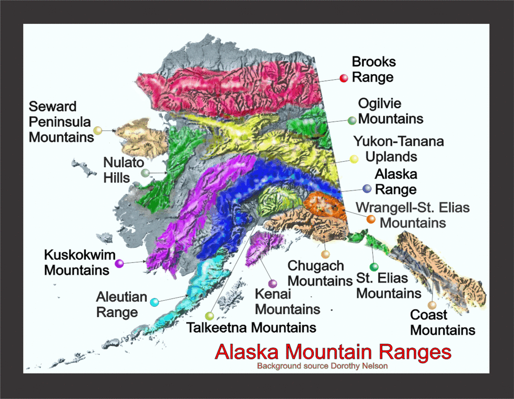
Alaska Mountain Ranges


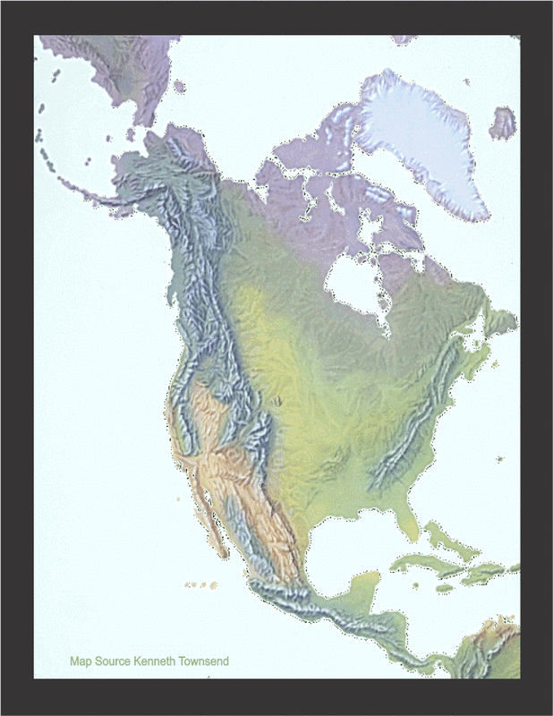
North America Cordillera
The North America Cordillera consists of a sequence of
mountains. Starting with, the Alaska Range and Brooks
Range, runs through Mackenzie Mts., Coast Mts., Rocky Mts.,
Sierra Nevada, Sierra Madre, through the mountains ranges
of Central America and becomes the Andes Mountain of
South America. Cordillera in Latin: Chorda: chord, rope.
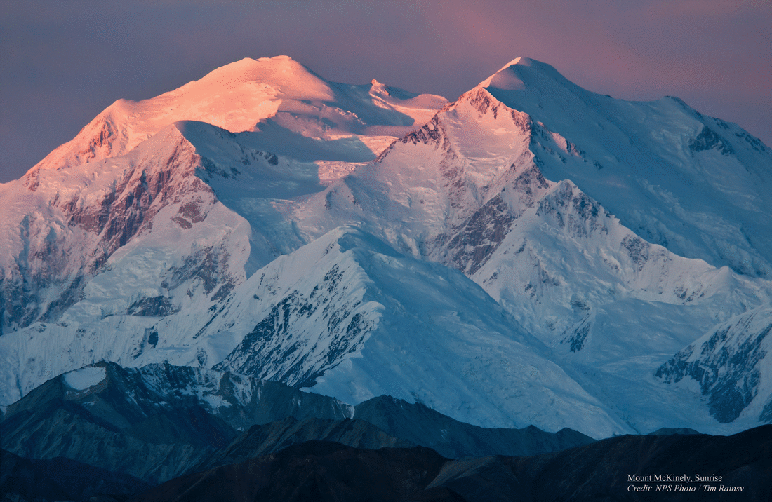
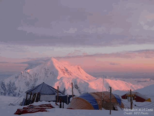
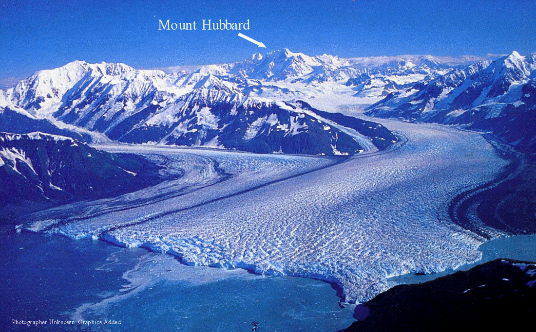
The North America Cordillera from the west contains the highest ranges in the mountain system. The Alaska Range with Mount McKinley the highest peak in North America elevation 20,237 ft., the chain of volcanic Aleutian Islands, St. Elias mountains continuing into Canada with Mount Logan elevation 19,551 ft. second tallest and then back to Alaska with St. Elias at an elevation 18,009 ft.
All glaciers types are represented in the North America Cordilleras.
mountains. Starting with, the Alaska Range and Brooks
Range, runs through Mackenzie Mts., Coast Mts., Rocky Mts.,
Sierra Nevada, Sierra Madre, through the mountains ranges
of Central America and becomes the Andes Mountain of
South America. Cordillera in Latin: Chorda: chord, rope.
The North America Cordillera from the west contains the highest ranges in the mountain system. The Alaska Range with Mount McKinley the highest peak in North America elevation 20,237 ft., the chain of volcanic Aleutian Islands, St. Elias mountains continuing into Canada with Mount Logan elevation 19,551 ft. second tallest and then back to Alaska with St. Elias at an elevation 18,009 ft.
All glaciers types are represented in the North America Cordilleras.
NORTH AMERICA CORDILLERA
Alaska Mountain Ranges
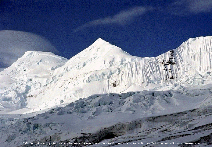
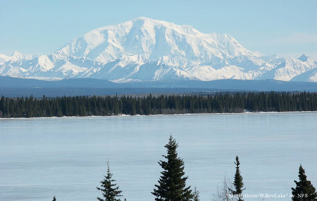
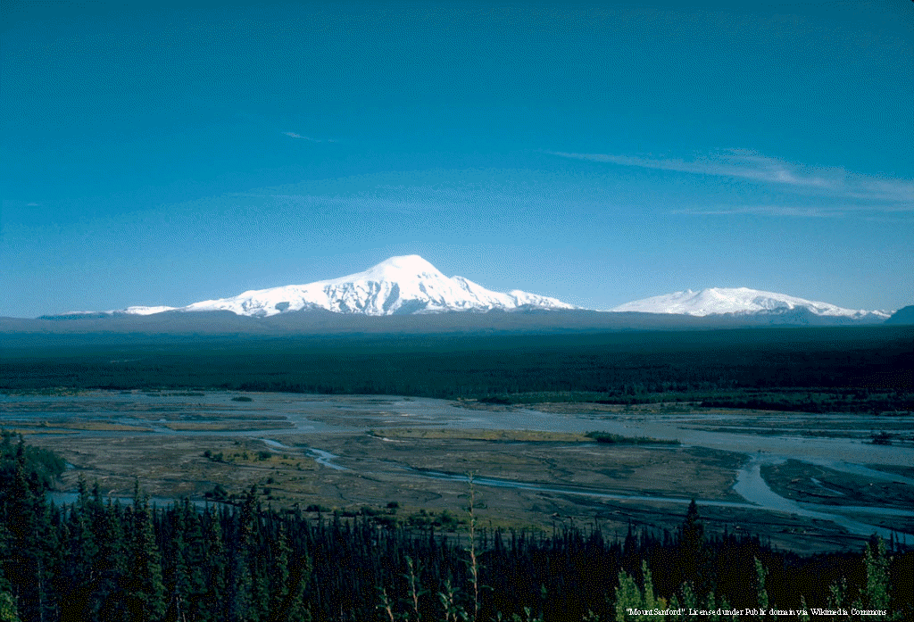
Alaska has fourteen major mountain ranges. The four major ranges are: the Alaska, Coast, Brooks and Aleutian Ranges. While cruising from Ketchikan to Skagway the Coast Range covers most of the southwest region. From Skagway to Whittier or Seward you sail along Wrangell-St. Elias Mountains and Chugach Mountains.
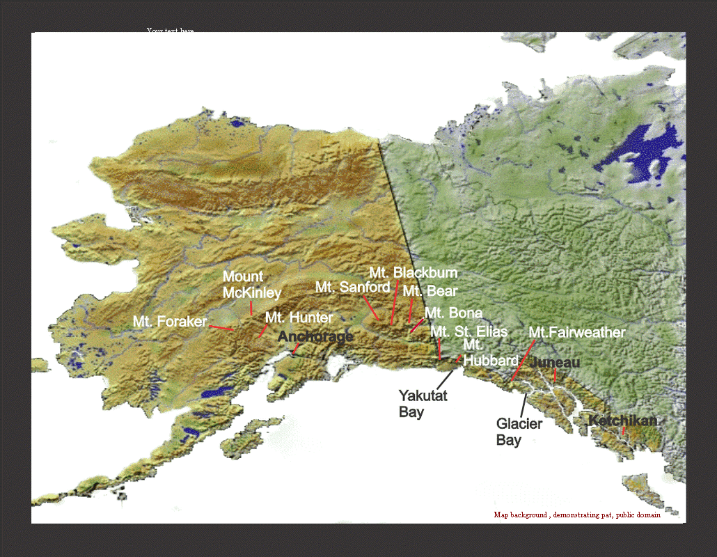
Top Ten Mountains General Locations
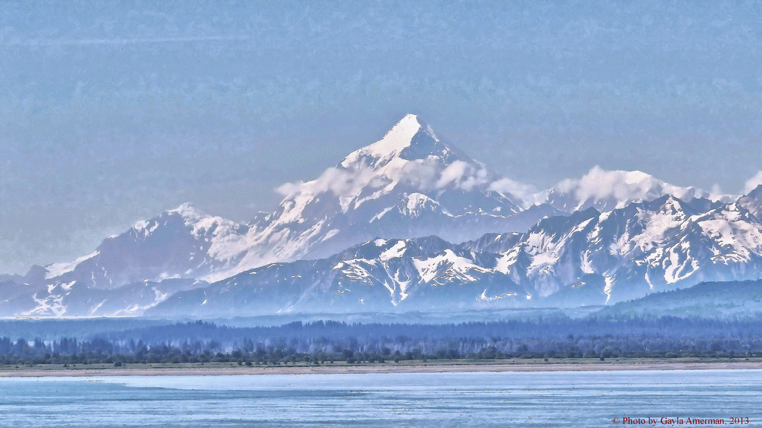
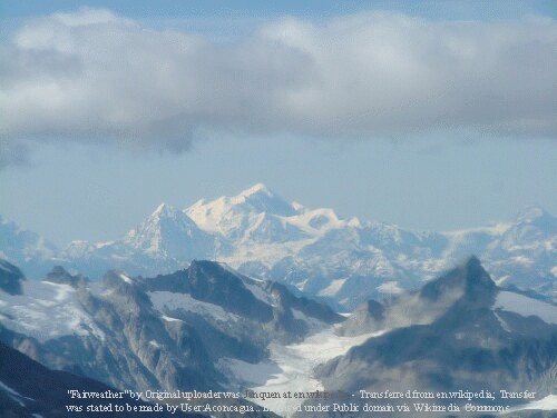
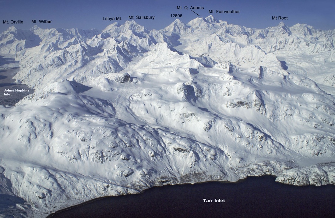
As you can see below the ten highest peaks in the United States run from Glacier Bay to Denali National Park. You can not see all from the ship, but two easiest to spot are: Mount Fairweather, and Mount St. Elias. Mount Fairweather elevation 15,299 ft. can be seen within Glacier Bay looking above Johns Hopkins Inlet and from the Pacific Ocean at Fairweather Glacier you can get a good photo. Mount St. Elias when you come to Icy Bay north of Yakutat Bay a good place to shot Mount St. Elias. Look at maps below, also look at the mountains around them.
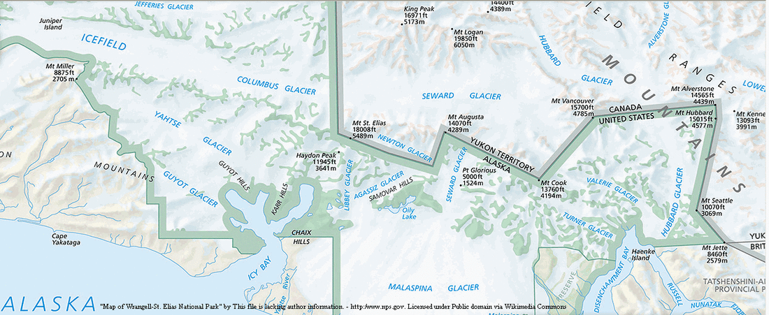
Maps showing Mt. Fairweather and Mt. St. Elias
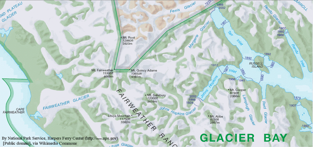
National Park Service Full maps, Mt. Fairweather (Glacier Bay) click on the park you want to see.
Mt. Saint Elias-(Wrangell-St. Elias National Park) Go to Park Tools-View Park Map
Top Ten Mountains Elevations

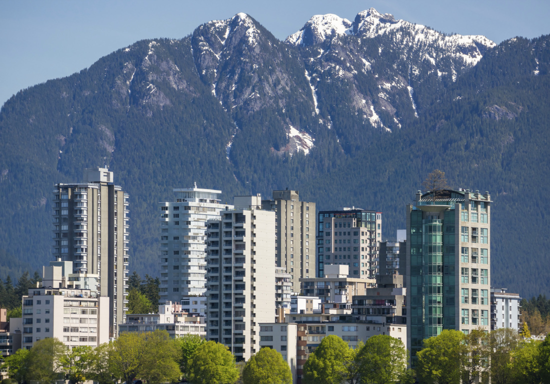
When you are in Seattle, Vancouver, or Anchorage look around, the beauty starts before you get on the ship.
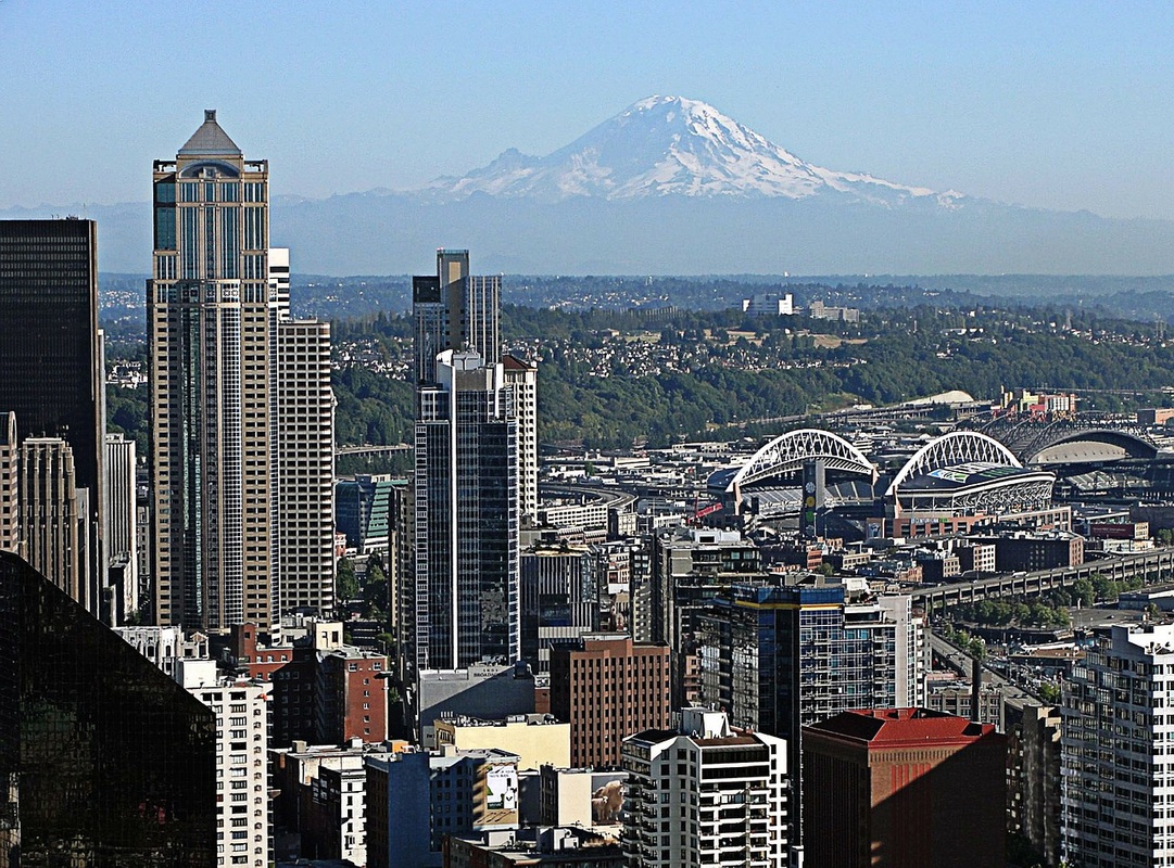

Anchorage Skyline By
Ken Graham Photography
Link
Ken Graham Photography
Link